
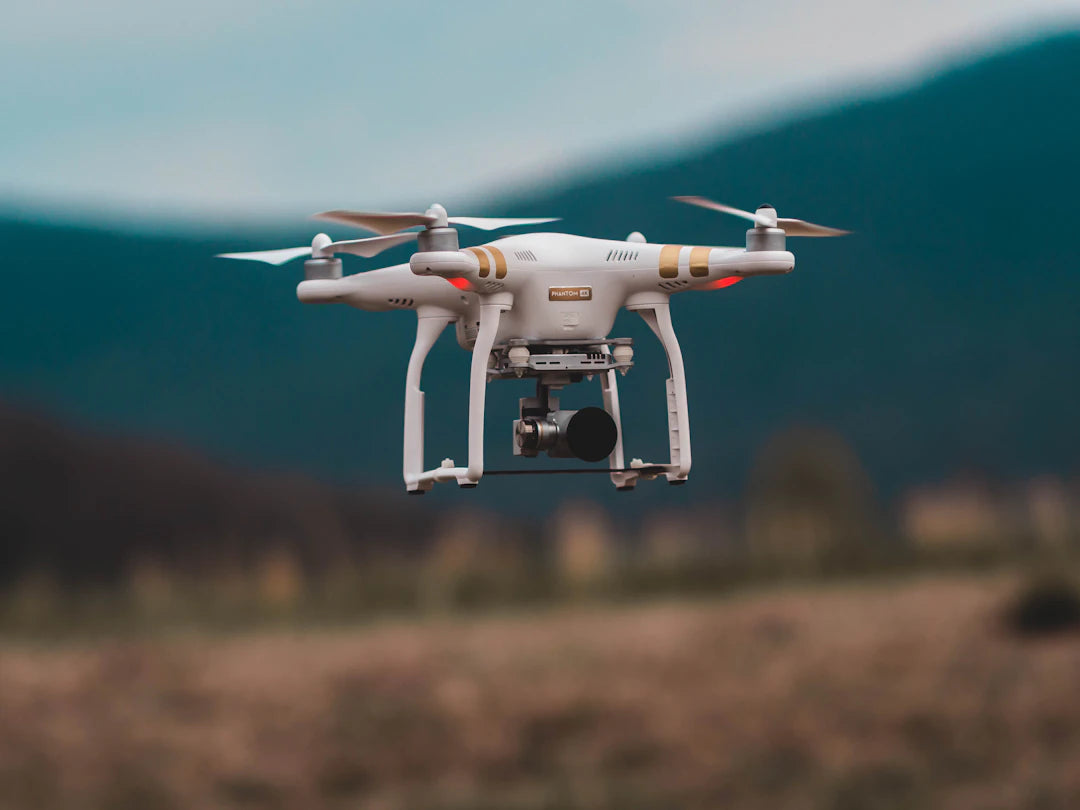
Precision Drones with Real-Time Kinematic (RTK) Technology
Overview
Drones with Real-Time Kinematic (RTK) technology are revolutionizing industries requiring high precision, such as surveying and mapping. This article reviews leading RTK drones and ground systems, highlighting their features and applications. Key products include the DJI D-RTK 3 Multifunctional Station, DJI Matrice D-RTK Ground System Kit, FreeFly RTK GPS Ground Station, and DJI Matrice 30T Enterprise Thermal Drone. When choosing an RTK drone, consider factors like precision needs, payload capacity, flight time, ease of use, and durability.
Table of Contents
In the world of aerial technology, drones equipped with Real-Time Kinematic (RTK) technology are revolutionizing industries that require pinpoint accuracy. Whether for surveying, mapping, or marine inspections, having the ability to achieve centimeter-level precision is invaluable. In this article, we will explore some of the leading RTK drones and ground systems, discussing their features, benefits, and ideal use cases. As we navigate through these advanced tools, you'll gain a comprehensive understanding of how they can enhance your operations.
Understanding RTK Technology
RTK technology is a satellite navigation technique used to enhance the precision of position data. By utilizing a fixed base station and a mobile receiver, RTK can provide real-time corrections, allowing drones to achieve incredible positional accuracy. This technology is particularly beneficial for tasks such as surveying, construction, and environmental monitoring, where even the slightest discrepancy can lead to significant errors.
The Game-Changers in RTK Drones
Let’s dive into some of the prominent RTK products that are setting the standard in precision drone technology.
DJI D-RTK 3 Multifunctional Station
The DJI D-RTK 3 Multifunctional Station is a groundbreaking tool that integrates high-performance antennas and receiver modules, capable of tracking and resolving data from multiple global satellite navigation systems. This station supports various data transmission links and leverages an advanced inertial measurement unit to analyze drone positioning and orientation.

This station can operate in multiple modes, offering a reliable base for multiple drones or extending their operational range in relay station mode. It’s particularly effective when integrated with the DJI ENTERPRISE app and DJI Terra, providing a streamlined solution for high-precision aerial surveying applications. Users should, however, note that measurement accuracy can be affected by various environmental factors.
DJI Matrice D-RTK Ground System Kit (Datalink Pro 900-G)

This system not only supports accurate positioning but also enhances altitude accuracy and provides a true heading resistant to magnetic interference. With support for both the DJI GO and Assistant 2 apps, users can calibrate their drones effectively and manage flight operations with ease.
FreeFly RTK GPS Ground Station
For those operating the Alta X or Astro drones, the FreeFly RTK GPS Ground Station is an ideal addition. This system utilizes RTK technology to deliver exceptional vertical and horizontal location accuracy, ensuring that even the most demanding aerial missions are executed flawlessly.

This ground station is designed to complement the capabilities of FreeFly drones, ensuring that operators can achieve the precision necessary for high-stakes operations. It's particularly suited for aerial inspections and mapping, making it a valuable tool in the arsenal of professional drone operators.
DJI Matrice 30T M30T Enterprise Thermal Drone
Rounding out our discussion is the DJI Matrice 30T M30T Enterprise Thermal Drone, a powerful tool designed for various commercial applications. With a maximum flight time of 41 minutes and the ability to withstand wind resistance up to 15 m/s, this drone is built for rugged conditions.

This drone features dual-vision and Time-of-Flight (ToF) sensors all around, ensuring a safe flight experience by providing timely warnings of incoming aircraft. It also supports OcuSync 3 Enterprise for enhanced video transmission quality, making it ideal for tasks such as thermal inspections, firefighting, and search and rescue operations.
Buyer’s Guide: Choosing the Right RTK Drone
When selecting a drone equipped with RTK technology, consider the following factors:
- Precision Needs: Determine the level of accuracy required for your specific application.
- Payload Capacity: Ensure the drone can carry any additional equipment, such as cameras or sensors.
- Flight Time: Longer flight times are crucial for extensive surveying or inspections.
- Ease of Use: Look for user-friendly interfaces and app support.
- Durability: Consider weather resistance and build quality, especially for outdoor use.
Conclusion
Drones with Real-Time Kinematic technology are transforming how industries approach aerial surveying and inspection. From the advanced features of the DJI D-RTK 3 Multifunctional Station to the remarkable capabilities of the DJI Matrice 30T M30T Enterprise Thermal Drone, these tools are designed to enhance operational efficiency and accuracy. By understanding your specific needs and evaluating the products available, you can make informed decisions that will elevate your aerial operations to new heights.
Key Takeaways
- RTK Technology: Enhances positional accuracy using satellite navigation, crucial for surveying and construction tasks.
- DJI D-RTK 3 Multifunctional Station: Offers multiple operational modes and integrates with DJI apps for high-precision aerial surveying.
- DJI Matrice D-RTK Ground System Kit: Improves communication between drones and base stations, ensuring centimeter-level 3D positioning.
- FreeFly RTK GPS Ground Station: Ideal for Alta X and Astro drones, providing exceptional accuracy for aerial inspections and mapping.
- DJI Matrice 30T M30T Drone: Features dual-vision sensors and a 41-minute flight time, suitable for thermal inspections and search and rescue missions.
- Buyer’s Guide: Key selection factors include precision needs, payload capacity, flight time, ease of use, and durability.
- Industry Impact: RTK drones are revolutionizing aerial operations, enhancing efficiency and accuracy across various sectors.
Pros and Cons
| Advantages of RTK Drones | Drawbacks of RTK Drones |
|---|---|
| Achieves centimeter-level precision for critical tasks. | Measurement accuracy can be affected by environmental factors. |
| Enhances operational efficiency in surveying and mapping. | Higher initial investment compared to standard drones. |
| Supports various applications, including construction and inspections. | Requires technical knowledge for optimal setup and operation. |
| Real-time corrections improve positional accuracy. | Limited flight time may restrict extensive operations. |
| Integration with advanced apps for easy management. | Potential compatibility issues with certain equipment. |
Who It's For (And Not For)
Who It's For
- Surveying Professionals: Those who require centimeter-level accuracy for land surveying and mapping tasks.
- Construction Managers: Individuals overseeing projects where precise measurements are critical for planning and execution.
- Environmental Monitors: Professionals needing accurate data for environmental assessments and monitoring activities.
- Aerial Inspectors: Operators conducting inspections of infrastructure, such as power lines or bridges, where precision is paramount.
- Drone Enthusiasts: Hobbyists or professionals looking to enhance their drone capabilities with advanced RTK technology.
Who It's Not For
- Casual Users: Individuals seeking a drone for recreational purposes without the need for high precision.
- Budget-Conscious Buyers: Those who are not willing to invest in advanced technology and systems that come with RTK drones.
- Short-Term Projects: Users with temporary needs that do not require the level of accuracy provided by RTK technology.
- Users in Low-Signal Areas: Individuals operating in environments where satellite signals may be weak, affecting RTK performance.
- Non-Technical Operators: Users who may struggle with the complexity of operating advanced drone systems without proper training.
Comparison at a Glance
| Option | Best for | Strengths | Trade-offs |
|---|---|---|---|
| DJI D-RTK 3 Multifunctional Station | Aerial surveying applications | High-performance antennas, multiple satellite system support, operational range extension. |
Measurement accuracy can be affected by environmental factors. |
| DJI Matrice D-RTK Ground System Kit (Datalink Pro 900-G) | Enhanced communication during flight | Accurate positioning, altitude accuracy, resistant to magnetic interference. |
Requires compatibility with DJI apps for full functionality. |
| FreeFly RTK GPS Ground Station | Aerial inspections and mapping | Exceptional vertical and horizontal accuracy, complements FreeFly drones. |
Limited to FreeFly drone models. |
| DJI Matrice 30T M30T Enterprise Thermal Drone | Commercial applications like thermal inspections | 41-minute flight time, rugged design, dual-vision sensors. |
May require additional investment for batteries and accessories. |
Frequently Asked Questions
1. What is RTK technology?
2. What are the benefits of using RTK drones?
3. Can you name some leading RTK drones?
4. What factors should I consider when choosing an RTK drone?
5. What applications are suitable for RTK drones?
Glossary
| Term | Meaning |
|---|---|
| RTK | Real-Time Kinematic; a satellite navigation technique for high precision. |
| Centimeter-Level Precision | Accuracy within a few centimeters, crucial for surveying tasks. |
| DJI D-RTK 3 | A multifunctional station for high-performance drone positioning. |
| Ground System Kit | A system that enhances communication between drones and base stations. |
| FreeFly RTK GPS | A ground station that provides exceptional location accuracy for FreeFly drones. |
| Matrice 30T | A thermal drone designed for commercial applications and rugged conditions. |
| OcuSync 3 | A technology for enhanced video transmission quality in drones. |
| Payload Capacity | The maximum weight a drone can carry, including equipment. |
| Flight Time | The duration a drone can remain airborne on a single charge. |
| Durability | The ability of a drone to withstand environmental conditions. |
%20technology%20are%20revolutionizing%20industries%20requiring%20high%20precision,%20such%20as%20surveying%20and%20mapping.%20This%20article%20reviews%20leading%20RTK%20drones%20and%20ground%20...)