
The Amazing Role of Drones in Disaster Management
Overview
Drones are transforming disaster management by providing real-time data, enhancing search and rescue operations, and facilitating quick damage assessments. Their benefits include cost-effectiveness, improved safety for responders, and advanced imaging capabilities. Despite challenges like regulatory approvals and public perception, the future of drones in this field looks promising with ongoing technological advancements. Education and training for effective drone use in emergencies are essential for maximizing their potential in disaster response and recovery.
Table of Contents
- The Evolution of Drones in Disaster Management
- Understanding the Benefits of Drones in Disasters
- Applications of Drones in Disaster Management
- Search and Rescue Missions
- Damage Assessment and Recovery
- Environmental Monitoring
- Challenges and Future Developments
- Education and Training on Drones in Disaster Management
- A Quick Look into Regulations
- Conclusion: Soaring Towards a Safer Future
In recent years, the advancement of technology has revolutionized many sectors, and disaster management is no exception. Drones, also known as unmanned aerial vehicles (UAVs), have emerged as pivotal tools for various applications in emergencies. From providing real-time data to enabling efficient rescue operations, the advantages of integrating drones into disaster management are compelling. This article will delve into the multifaceted role of drones in disaster management, focusing on their benefits, applications, and future potential.
The Evolution of Drones in Disaster Management
Initially utilized for military purposes, drones have transitioned into civilian applications, most notably in disaster response and recovery. This evolution has paved the way for enhanced data collection, improved logistics, and more effective search and rescue missions. Here's how drones are connecting the dots in the disaster management realm:
- Real-Time Data Collection: Drones provide immediate situational awareness.
- Search and Rescue Operations: They can cover large areas quickly and access hard-to-reach locations.
- Delivery of Supplies: Drones can transport food, water, and medical supplies directly to those in need.
- Damage Assessment: Aerial views facilitate faster assessments, getting teams on the ground sooner.
Understanding the Benefits of Drones in Disasters
When it comes to disaster management, it's crucial to have efficient and timely interventions. Drones come equipped with various technologies that allow for better preparedness and response strategies. Here are several benefits of incorporating drones in disaster management:
| Benefit | Description |
|---|---|
| Cost-Effective | Drones can significantly reduce the manpower and time required in disaster assessments. |
| Enhanced Safety | Utilizing drones reduces risks for first responders by surveying dangerous areas remotely. |
| Speed and Agility | Drones can be deployed quickly and cover substantial ground quickly, offering faster responses. |
| Advanced Imaging | Equipped with thermal and high-resolution imaging, drones can provide important visual data. |
Applications of Drones in Disaster Management
Drone technology has found various applications across different disaster scenarios. Below are key areas where drones play a significant role:
Search and Rescue Missions
Drones have revolutionized search and rescue operations, especially in environments that are hazardous for search teams. Equipped with advanced sensors and cameras, drones can:
- Locate missing persons by identifying heat signatures.
- Survey areas that are flooded or otherwise inaccessible.
- Provide live aerial footage to help command centers make strategic decisions.
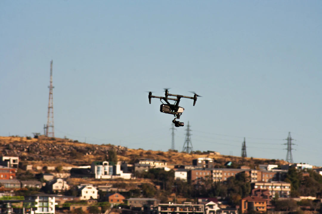
Damage Assessment and Recovery
After a disaster strikes, evaluating the extent of damage is essential. Drones like the DJI Matrice 400 are perfect for this purpose, as they can offer high-definition aerial views of affected areas.
The benefits of utilizing drones for damage assessments include:
- Providing comprehensive mapping of affected regions.
- Facilitating efficient analysis of structural integrity.
- Gathering data to inform recovery efforts and policy changes.
Environmental Monitoring
Drones also play a crucial role in environmental observation during and after disasters. They can be used to:
- Monitor forest fires, helping to control the spread.
- Survey marine environments for damage and recovery efforts with marine inspection drones.
- Assess air quality post-disaster, ensuring public safety.
Challenges and Future Developments
While the benefits of drones in disaster management are extensive, there are challenges to consider. Key issues include:
- Regulatory Approvals: Compliance with local regulations can slow down deployment.
- Technical Limitations: Battery life and remote operation distances have their constraints.
- Public Perception: Misunderstandings about drone uses may lead to pushback from communities.
The future of drones in disaster management looks promising, though. Innovations in battery technology, AI-enhanced data analysis, and improved sensors are likely to propel further integration into disaster management activities.
Education and Training on Drones in Disaster Management
As drones become increasingly utilized in emergency scenarios, education and training become essential. First responders and disaster management teams must understand how to operate drones efficiently. This includes:
- Understanding the technical specifications of drone models.
- Training in drone flight operations and safety regulations.
- Learning data analysis techniques to interpret gathered information.
A Quick Look into Regulations
The integration of drones into disaster management is governed by regulations that vary by region. Most countries require specific licensing for drone operators, especially in emergency response situations. Familiarity with these regulations is vital for smooth operational processes. A drone operator should be aware of:
- Airspace restrictions.
- Privacy concerns surrounding drone operations.
- Local laws governing emergency response activities.
Conclusion: Soaring Towards a Safer Future
Drones have made impressive strides in transforming disaster management practices, enhancing the efficiency and effectiveness of operations. Their ability to provide real-time data, conduct search and rescue missions, and facilitate damage assessments are invaluable during critical times. As drone technology continues to evolve alongside regulatory frameworks and public perception, we can look forward to a future where these innovative tools help communities around the world recover faster and more efficiently from disasters.
The world is looking up, and with every flight, drones bring us closer to a safer, more resilient future.
Key Takeaways
- Real-Time Data Collection: Drones provide immediate situational awareness during emergencies, enhancing decision-making.
- Search and Rescue Operations: Drones can quickly cover large areas and access hard-to-reach locations, improving rescue efforts.
- Delivery of Supplies: Drones can transport essential items like food, water, and medical supplies directly to those in need.
- Damage Assessment: Aerial views from drones facilitate faster damage evaluations, allowing for quicker response and recovery.
- Cost-Effective Solutions: Utilizing drones reduces the manpower and time needed for disaster assessments, making operations more efficient.
- Environmental Monitoring: Drones can monitor conditions such as forest fires and air quality, aiding in public safety post-disaster.
- Future Innovations: Advancements in battery technology, AI, and sensors are expected to enhance the integration of drones in disaster management.
Pros and Cons
| Advantages of Drones in Disaster Management | Drawbacks of Drones in Disaster Management |
|---|---|
| Real-time data collection enhances situational awareness. | Regulatory approvals can delay deployment. |
| Improved safety for first responders by surveying dangerous areas remotely. | Technical limitations such as battery life and range constraints. |
| Cost-effective solutions reduce manpower and time in assessments. | Public perception issues may lead to community pushback. |
| Speed and agility allow for rapid deployment in emergencies. | Need for education and training for effective operation. |
| Advanced imaging provides critical visual data for decision-making. | Privacy concerns surrounding drone surveillance. |
Linked Product

DJI Matrice 400 Enterprise Drone, Long-Endurance Drone Platform
The DJI Matrice 400 Enterprise Drone is designed for long-duration operations with a remarkable flight time of up to 59 minutes, making it suitable for emergency response, power inspections, and large-scale mapping. Its advanced obstacle sensing capabilities, including rotating LiDAR and mmWave radar, enhance safety in challenging environments, allowing it to navigate effectively around power lines and other obstacles. With a payload capacity of up to 6 kg and compatibility with various gimbals, this drone provides versatility for a wide range of applications.
View ProductWho It's For (And Not For)
Who It's For
- Emergency Responders: Those involved in disaster management who require efficient tools for real-time data collection and rapid response.
- Search and Rescue Teams: Teams looking to enhance their capabilities in locating missing persons and surveying hazardous environments.
- Logistics Coordinators: Individuals responsible for delivering supplies and assessing damage in disaster-stricken areas.
- Environmental Monitoring Agencies: Organizations focused on assessing environmental impacts during and after disasters.
Who It's Not For
- Individuals Unfamiliar with Technology: Those who lack the technical skills to operate drones effectively may find their use challenging.
- Areas with Strict Regulations: Locations where drone usage is heavily restricted or regulated may hinder effective deployment.
- Communities with Negative Perceptions: Areas where residents have misconceptions about drones may face pushback against their use in disaster management.
- Organizations with Limited Budgets: Groups that cannot afford the investment in drone technology and training may struggle to implement these tools.
Frequently Asked Questions
1. What are the main benefits of using drones in disaster management?
2. How do drones assist in search and rescue operations?
3. What challenges do drones face in disaster management?
4. What role do drones play in damage assessment after a disaster?
5. Why is education and training important for drone operators in disaster management?
Glossary
| Term | Meaning |
|---|---|
| Drones | Unmanned aerial vehicles used for various applications, including disaster management. |
| Real-Time Data | Immediate information collected during emergencies for situational awareness. |
| Search and Rescue | Operations aimed at locating and assisting individuals in distress. |
| Damage Assessment | Evaluation of destruction caused by disasters to inform recovery efforts. |
| Cost-Effective | Reducing expenses and resource needs in disaster response. |
| Enhanced Safety | Minimizing risks for responders by using drones in hazardous areas. |
| Advanced Imaging | High-resolution and thermal imaging technologies used by drones. |
| Regulatory Approvals | Compliance with laws governing drone operations in emergency situations. |
| Public Perception | The community's understanding and acceptance of drone usage. |
| Environmental Monitoring | Using drones to observe and assess environmental conditions post-disaster. |
