
Transforming Urban Planning: Drones for Local Governments
Overview
Local governments can greatly enhance urban planning by integrating drone technology for data collection, mapping, and community engagement. Drones offer rapid and cost-effective surveys, improve infrastructure inspections, aid environmental assessments, and facilitate monitoring of urban growth. However, legal and ethical considerations must be addressed, alongside staff training. Embracing drones can lead to more sustainable and efficient city planning, ultimately benefiting citizens and the environment.
Table of Contents
- The Role of Drones in Urban Planning
- Data Collection and Mapping
- Visualizations for Better Engagement
- Enhancing Infrastructure Inspections
- Environmental Impact Assessments
- Monitoring Urban Growth
- Incorporating Community Feedback
- Legal and Ethical Considerations
- Training and Education
- The Future of Drones in Urban Planning
- Expanding Drone Technology: A Comprehensive Approach
- Seizing the Opportunity for Better Urban Planning
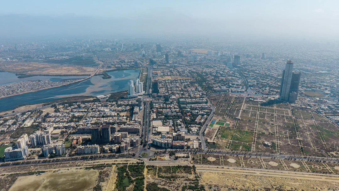
As urban environments continue to grow and evolve, local governments face the daunting challenge of planning effectively to ensure sustainability, efficiency, and the well-being of citizens. With increasing population density and the need for innovative solutions, leveraging technology has never been more vital. One exciting technological advancement is the rise of drones. In this article, we will explore how local governments can utilize drones for urban planning, highlighting the benefits, applications, and best practices for implementation.
The Role of Drones in Urban Planning
Drones, or unmanned aerial vehicles (UAVs), have emerged as game-changers in various sectors, including construction, agriculture, and environmental monitoring. In the realm of urban planning, drones are proving to be indispensable tools that enable local governments to collect valuable data, improve decision-making, and engage with communities effectively. Here’s a closer look at how drones are reshaping urban planning.
Data Collection and Mapping
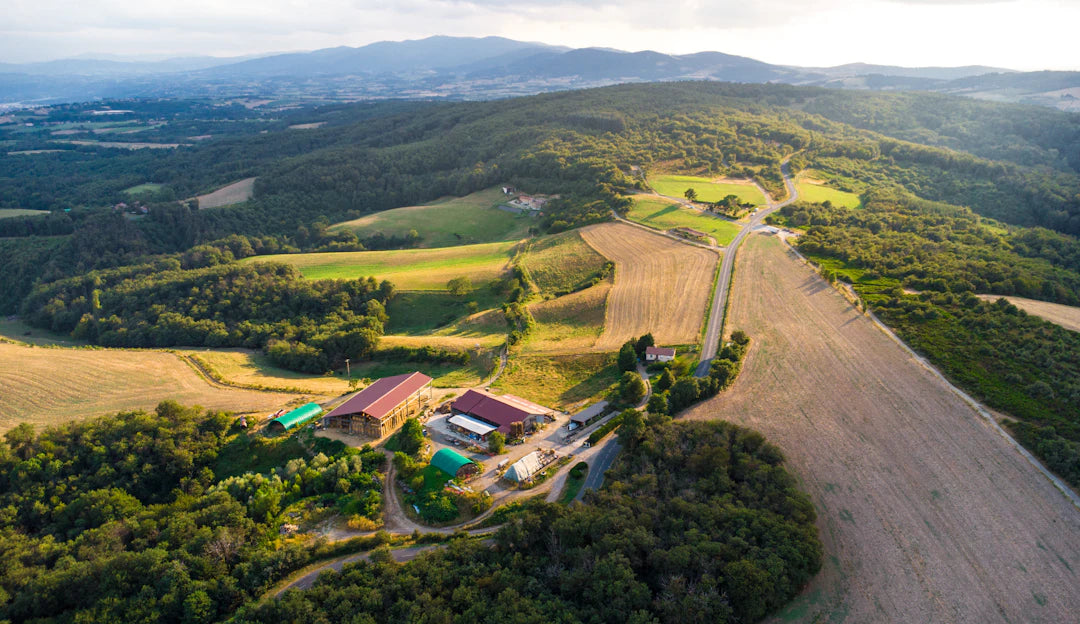
One of the primary advantages of using drones for urban planning is their ability to collect high-resolution aerial imagery and data quickly and efficiently. This data is crucial for mapping terrains, analyzing land use, and visualizing potential development sites. Drones equipped with advanced sensors can capture detailed information on topography, vegetation, infrastructure, and more, allowing planners to make well-informed decisions.
- Rapid Response: Drones can quickly survey areas that may be difficult or dangerous for humans to access.
- Cost-Effective: Mapping via drones significantly reduces the time and costs associated with traditional surveying methods.
- Updated Information: Regular drone surveys can provide current data, ensuring urban plans are based on accurate and relevant information.
Visualizations for Better Engagement
Drones don't just gather data; they also enable local governments to create stunning visualizations for community engagement. By generating 3D models and aerial photographs, officials can present urban development plans to citizens in a clear and engaging manner. This transparency fosters public trust and encourages community feedback.
Enhancing Infrastructure Inspections
Infrastructure maintenance and inspections can be labor-intensive and time-consuming processes. By implementing automated flight modes drone technology, local governments can streamline these inspections. Drones equipped with thermal imaging and high-resolution cameras can efficiently monitor the condition of bridges, roads, public buildings, and utilities.
| Inspection Type | Drone Application | Benefits |
|---|---|---|
| Bridges | Visual and thermal imaging | Identifies structural issues quickly |
| Roads | Surface mapping | Monitors wear and erosion |
| Buildings | Aerial surveys | Efficiency in maintenance checks |
| Utilities | Power line inspections | Enhances safety for workers |
Environmental Impact Assessments
Urban planning is closely tied to environmental sustainability, and drones can play a key role in conducting environmental impact assessments (EIAs). With the capability to capture data on air quality, vegetation health, and land use changes, drones provide critical insights that help planners evaluate potential effects on the environment before approving new projects.
Monitoring Urban Growth
As cities evolve, monitoring urban growth becomes essential for effective planning. Drones can assist in tracking urban sprawl, understanding land development patterns, and providing real-time data about changes in infrastructure and demographics. By having access to historical data compared with current aerial views, urban planners can make predictive analyses that guide future development strategies.
Incorporating Community Feedback
Community engagement is vital for the success of urban planning initiatives. Local governments can leverage drone technology to host aerial surveys that allow citizens to visualize proposed developments from a broader perspective. By incorporating community feedback, planners can adapt projects to better serve public interests, which ultimately leads to higher satisfaction and support for new initiatives.
Legal and Ethical Considerations
While the potential benefits of using drones for urban planning are significant, local governments must also navigate legal and ethical challenges. Compliance with federal and local regulations on drone usage is crucial to ensure safety and privacy. Here are some critical points to consider:
- Obtain necessary permits from aviation authorities.
- Ensure drones are operated by licensed pilots.
- Implement policies on data collection, storage, and sharing to protect citizen privacy.
Training and Education
For successful integration of drones into urban planning processes, local government staff must undergo proper training. Understanding how to operate drones effectively, interpret collected data, and engage with the community will empower officials and enhance the technology's impact. Local governments can consider workshops, conferences, and partnerships with technology experts to facilitate ongoing education in this rapidly evolving field.
The Future of Drones in Urban Planning
The use of drones in urban planning is expanding, and local governments are at the forefront of this revolution. As technology continues to advance, we can expect drones to become even more integral to city planning processes. Potential future applications include:
- Integration with Smart City Initiatives: Drones could play a significant role in the development of smart cities, utilizing data to optimize resources.
- Emergency Response: Drones could monitor urban environments in real-time during disasters, providing critical information to first responders.
- Real-Time Traffic Management: Utilizing automated flight modes drone technology could help in monitoring traffic patterns and alleviating congestion.
Expanding Drone Technology: A Comprehensive Approach
As local governments explore the full range of capabilities offered by drones, they can benefit from diving into various aspects of drone technology. For instance, understanding how to harness underwater drones can offer an even broader scope for urban planning, especially in coastal cities or those near rivers. An Underwater Drone Buying Guide could serve as an essential resource for local governments interested in expanding their aerial data collection to aquatic environments.
Seizing the Opportunity for Better Urban Planning
With the unparalleled advantages that drones offer, local governments have the opportunity to revolutionize urban planning practices. By investing in drone technologies, creating strong regulations, and prioritizing community engagement, cities can accelerate their planning processes and improve decision-making regarding future developments. The integration of drone technology can become a cornerstone for creating sustainable, smart cities that prioritize the needs of their citizens while preserving the environment.
As we move towards a more technologically driven future, those who embrace the use of drones in urban planning will undoubtedly gain a competitive edge, ensuring efficiency, safety, and satisfaction among communities. The sky truly is not the limit for what drones can achieve in transforming urban landscapes.
Key Takeaways
- Drones enhance data collection: They provide high-resolution aerial imagery and data for effective mapping and land use analysis.
- Cost-effective urban planning: Utilizing drones significantly reduces time and costs compared to traditional surveying methods.
- Improved community engagement: Drones enable the creation of 3D models and visualizations, fostering transparency and public trust.
- Streamlined infrastructure inspections: Drones automate inspections of bridges, roads, and utilities, enhancing efficiency and safety.
- Support for environmental assessments: Drones capture critical data for evaluating the environmental impacts of urban development projects.
- Facilitation of community feedback: Aerial surveys allow citizens to visualize proposed developments, leading to better project adaptation.
- Future integration with smart cities: Drones are expected to play a key role in emergency response and real-time traffic management.
Pros and Cons
| Advantages of Using Drones in Urban Planning | Drawbacks of Using Drones in Urban Planning |
|---|---|
| High-resolution data collection for accurate mapping. | Legal and regulatory compliance can be complex. |
| Cost-effective compared to traditional surveying methods. | Privacy concerns regarding data collection and surveillance. |
| Enhances community engagement through visualizations. | Requires trained personnel to operate drones effectively. |
| Improves efficiency in infrastructure inspections. | Potential for technological malfunctions or failures. |
| Facilitates real-time monitoring of urban growth. | Initial investment costs for drone technology can be high. |
Linked Product

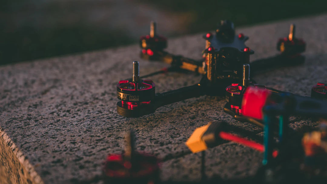
HOVERAir X1 PROMAX 8K Flying Camera Drone
The HOVERAir X1 PROMAX 8K Flying Camera Drone offers high-definition aerial photography with its powerful 8K camera and various automated flight modes, making it suitable for capturing dynamic cinematic moments. With its compact, foldable design and advanced features like OmniTerrain capability and rear collision detection, this drone is designed for easy use in diverse conditions. Additionally, its enhanced follow functions and smooth stabilization ensure steady footage for both casual users and professional applications.
View ProductWho It's For (And Not For)
Who It's For
- Local Government Officials: Those involved in urban planning and development who seek innovative solutions to enhance efficiency and sustainability.
- Urban Planners: Professionals looking to utilize advanced technology for data collection, mapping, and community engagement.
- Environmental Advocates: Individuals focused on assessing and improving environmental impacts through accurate data and monitoring.
- Community Engagement Facilitators: Those interested in fostering public trust and feedback through transparent visualizations of urban projects.
Who It's Not For
- Small Towns with Limited Resources: Local governments with very few resources may find it challenging to implement drone technology effectively.
- Individuals Opposed to Technology: Those who prefer traditional methods of urban planning and are resistant to adopting new technologies.
- Areas with Strict Regulations: Regions where drone usage is heavily restricted may not benefit from this technology.
- Government Officials Lacking Training: Those who do not have access to training programs or educational resources for effective drone operation and data interpretation.
Frequently Asked Questions
1. How can drones be utilized in urban planning?
2. What are the benefits of using drones for data collection in urban planning?
3. What legal and ethical considerations must local governments take into account when using drones?
4. How do drones enhance community engagement in urban planning?
5. What does the future hold for drones in urban planning?
Glossary
| Term | Meaning |
|---|---|
| Drones | Unmanned aerial vehicles used for data collection and monitoring. |
| Urban Planning | The process of designing and managing land use in urban areas. |
| Data Collection | Gathering information for analysis and decision-making. |
| Environmental Impact Assessment (EIA) | A study to evaluate the effects of a project on the environment. |
| Community Engagement | Involving citizens in the planning process to gather feedback. |
| Smart Cities | Urban areas that use technology to improve services and quality of life. |
| Thermal Imaging | A technique to visualize heat patterns for inspections. |
| Real-Time Data | Information collected and processed instantly for immediate use. |
| Automated Flight Modes | Pre-programmed drone operations for efficient data collection. |
| Regulations | Rules governing the use of drones to ensure safety and privacy. |