Drones and Data Collection: Revolutionizing Information Gathering
Overview
Drones are revolutionizing data collection across various industries by providing efficient, cost-effective, and accurate methods for gathering information. Equipped with advanced technologies like high-resolution cameras and LiDAR, drones enhance operations in agriculture, construction, and environmental monitoring. While they offer significant benefits, challenges such as regulatory compliance and data privacy must be considered. The future of drone technology promises increased automation and integration with IoT, making them essential tools for data-driven decision-making.
Table of Contents
- The Evolution of Drones in Data Collection
- Key Technologies Driving Drone Data Collection
- Benefits of Using Drones for Data Collection
- Cost Efficiency
- Speed and Efficiency
- Access to Hard-to-Reach Areas
- Enhanced Accuracy
- Sector-Specific Applications of Drones
- Agriculture
- Construction
- Environmental Monitoring
- Real Estate and Marketing
- Challenges and Considerations
- Regulatory Hurdles
- Data Privacy and Security
- Future Directions in Drone Data Collection
- Choosing the Right Drone for Data Collection
- Define Your Purpose
- Evaluate Specifications
- Research Reviews and Comparisons
- A Sky Full of Possibilities
As technology continues to advance, drones have emerged as a game-changer in various industries. The ability to collect data quickly, efficiently, and from unique perspectives is transforming how businesses operate. In this article, we will explore the role of drones in data collection, highlighting their key benefits, applications, and the tools that make them effective. Let’s dive into this innovative world that’s making information gathering more robust than ever.
The Evolution of Drones in Data Collection
Drones, also known as unmanned aerial vehicles (UAVs), have evolved significantly since their inception. Initially used for military applications, they have transitioned into commercial use, offering vast opportunities for data collection across multiple sectors. The evolution of drones has brought forward sophisticated technology, making it easier than ever to leverage aerial data.
Key Technologies Driving Drone Data Collection
Modern drones are equipped with advanced technologies that enhance their data collection capabilities. These technologies include:
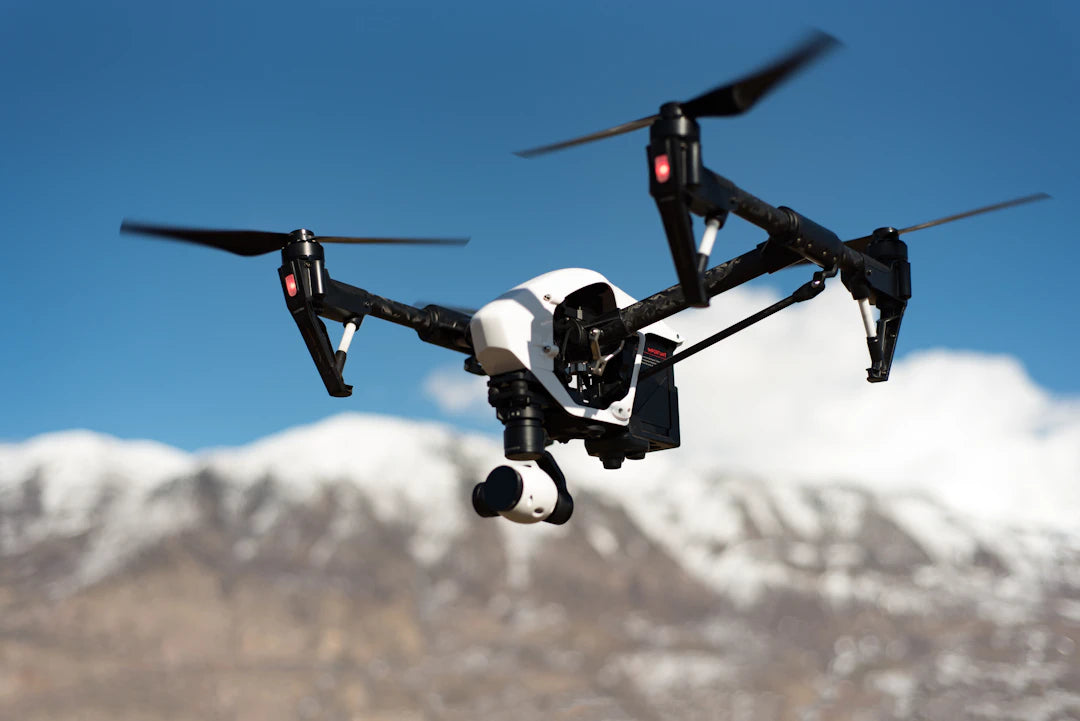
- High-Resolution Cameras: Drones can be fitted with top commercial drone cameras, enabling them to capture high-quality images and videos from the sky.
- LiDAR: Light Detection and Ranging (LiDAR) is a laser-based technology that measures distances, creating precise 3D models of the ground and structures.
- GPS and Mapping Software: Advanced navigation systems allow drones to conduct precise mapping and surveying tasks.
- Real-Time Data Transmission: Many drones now come with the ability to transmit data in real time, facilitating immediate analysis and decision-making.
Benefits of Using Drones for Data Collection
Utilizing drones for data gathering offers numerous benefits across various sectors. Here are some key advantages:
Cost Efficiency
Drones reduce operational costs by minimizing the need for extensive ground crews and expensive equipment. For example, a ready to fly drone kit can be a cost-effective alternative to traditional methods of data collection, such as manned aircraft or satellite imagery.
Speed and Efficiency
Data collection processes that traditionally took days or weeks can now be completed in mere hours with drones. Their ability to quickly cover large areas allows for timely information gathering that is crucial in many decision-making scenarios.
Access to Hard-to-Reach Areas
Drones are a perfect solution for exploring areas that are difficult or dangerous for humans to access. Whether it's surveying remote terrain or inspecting skyscrapers, drones can navigate challenging conditions with ease.
Enhanced Accuracy
| Data Collection Method | Accuracy Level | Cost Effectiveness |
|---|---|---|
| Drones with Camera | High | Medium |
| Satellite Imagery | Medium | High |
| Ground Surveying | Very High | Low |
Sector-Specific Applications of Drones
Drones are being utilized across numerous industries for various data collection tasks. Here’s a closer look at their applications:
Agriculture
In the agricultural sector, drones are revolutionizing farm management and crop monitoring. They can assess crop health, monitor irrigation, and provide valuable data for precision farming strategies. This helps farmers make informed decisions about resource allocation and crop management.
Construction
Drones provide construction companies with comprehensive site surveys, progress tracking, and inspections. With the ability to deliver high-resolution images and video footage, they streamline communication and project oversight, ensuring that projects stay on track.
Environmental Monitoring
Drones are key players in environmental monitoring, allowing scientists and researchers to gather data on wildlife, vegetation health, water quality, and more. This data aids in conservation efforts and informs policy decisions regarding environmental management.
Real Estate and Marketing
The real estate industry benefits from drone technology as agents use aerial photography to showcase properties from captivating angles. This enhances listings and provides potential buyers with detailed views of properties and their surroundings, boosting engagement and interest.
Challenges and Considerations
While drones have revolutionized data collection, there are challenges to consider:
Regulatory Hurdles
The use of drones is subject to regulations that vary by country and local jurisdiction. It is crucial for businesses to familiarize themselves with these regulations prior to deploying drones for data collection. Understanding airspace restrictions and obtaining necessary permits can be a complex process.
Data Privacy and Security
Gathering data through drones raises concerns over privacy and data security. Businesses must ensure compliance with privacy laws and take measures to protect sensitive information while conducting aerial surveys.
Future Directions in Drone Data Collection
The future of drone technology holds exciting potential for further enhancing data collection methods. Emerging trends to watch include:
- Increased Automation: As AI technologies mature, we can expect drones to become more autonomous, allowing for less hands-on operation and even greater efficiencies.
- Integration with Other Technologies: The combination of drones with IoT devices and big data analytics can create advanced data collection ecosystems that provide real-time insights.
- Enhanced Payloads: Innovations in payload technology may lead to the development of drones capable of carrying multiple sensors, providing a wider variety of data in a single flight.
Choosing the Right Drone for Data Collection
Selecting the ideal drone for your data collection needs depends on various factors, such as intended applications, budget, and specific requirements. Here are some tips for making an informed choice:
Define Your Purpose
Consider what specific data you need to collect. Whether for mapping, surveying, monitoring, or inspection, identifying your purpose will guide your choice of equipment. For example, if you need precise agricultural assessments, choose drones equipped with multispectral or thermal cameras.
Evaluate Specifications
When examining drone options, assess specifications like flight time, camera quality, and sensor capabilities. Drones that come as a ready to fly drone kit can simplify setup and use, making them user-friendly for beginners.
Research Reviews and Comparisons
Before making a purchase, research user reviews and comparison charts of available models. This can offer insights into performance, durability, and overall user satisfaction.
A Sky Full of Possibilities
The integration of drones into data collection processes has undeniably transformed how information is gathered and analyzed. From agriculture to environmental monitoring, the versatility of drones is paving the way for innovative solutions and improved efficiency across various sectors. As technology continues to advance, the skies will become even more crowded with possibilities, making drones a must-have tool for any industry looking to thrive in a data-driven world. Embrace the future and leverage the incredible power of drone technology for your data collection needs!
Key Takeaways
- Drones have evolved from military use to commercial applications, significantly enhancing data collection capabilities.
- Advanced technologies such as high-resolution cameras, LiDAR, and real-time data transmission improve the accuracy and efficiency of data gathering.
- Utilizing drones can lead to cost savings by reducing the need for extensive ground crews and traditional data collection methods.
- Drones can access hard-to-reach areas, making them ideal for surveying remote terrain and conducting inspections in hazardous locations.
- Applications of drones span various industries, including agriculture, construction, environmental monitoring, and real estate.
- Businesses must navigate regulatory hurdles and ensure data privacy when deploying drones for data collection.
- The future of drone technology includes increased automation and integration with IoT and big data analytics for enhanced data collection.
Pros and Cons
| Advantages of Drones for Data Collection | Drawbacks of Drones for Data Collection |
|---|---|
| Cost-effective alternative to traditional data collection methods. | Subject to varying regulations and legal restrictions. |
| Rapid data collection, reducing time from days to hours. | Potential privacy and data security concerns. |
| Access to hard-to-reach or dangerous areas. | Requires understanding of technical specifications for optimal use. |
| Enhanced accuracy in data gathering through advanced technology. | Initial investment costs for high-quality drones and equipment. |
| Versatile applications across various industries. | Dependence on weather conditions for effective operation. |
Linked Product

DJI Matrice 30T M30T Complete Ready to Fly Kit (2 Batteries, No Care)
The DJI Matrice 30T M30T Complete Ready to Fly Kit is designed for commercial drone pilots, offering powerful flight performance with a maximum flight time of 41 minutes and robust wind resistance. Its advanced environmental adaptability allows it to operate in a wide range of temperatures and weather conditions, while built-in safety features ensure reliable mission execution. The kit includes multiple camera options for versatile data capture, making it suitable for various aerial data collection needs.
View ProductWho It's For (And Not For)
Who It's For
- Businesses in Agriculture: If you're involved in farming or agricultural management, drones can significantly enhance crop monitoring and resource allocation.
- Construction Companies: Drones can streamline site surveys and inspections, making them ideal for construction projects that require precise oversight.
- Environmental Researchers: If you're focused on wildlife or environmental studies, drones can provide invaluable data for monitoring and conservation efforts.
- Real Estate Professionals: Drones are perfect for creating captivating aerial photography to enhance property listings and attract potential buyers.
- Organizations Seeking Cost Efficiency: If you need an affordable alternative to traditional data collection methods, drones can reduce operational costs significantly.
Who It's Not For
- Those Unfamiliar with Regulations: If you are not prepared to navigate the complex regulations surrounding drone usage, you may face legal challenges.
- Individuals Concerned About Data Privacy: If privacy concerns are paramount for your data collection efforts, drones may pose risks that you are not willing to accept.
- Businesses with Limited Budgets: If your budget does not allow for investment in drone technology or the necessary training, this may not be the right solution for you.
- Organizations Needing High Precision: If your data collection requires the highest level of accuracy that drones cannot provide, you may need to consider alternative methods.
- Those Seeking Hands-On Control: If you prefer traditional methods that require direct human oversight, the automation of drones might not align with your operational style.
Frequently Asked Questions
1. What are drones used for in data collection?
2. What are the key technologies in modern drones?
3. What benefits do drones offer for data collection compared to traditional methods?
4. What challenges are associated with using drones for data collection?
5. How can I choose the right drone for my data collection needs?
Glossary
| Term | Meaning |
|---|---|
| Drones | Unmanned aerial vehicles used for various applications. |
| LiDAR | A laser-based technology for creating 3D models. |
| GPS | Global Positioning System for navigation and mapping. |
| Data Transmission | Real-time sending of data for immediate analysis. |
| Cost Efficiency | Reduction of operational expenses through drone use. |
| Precision Farming | Data-driven farming practices for better resource management. |
| Environmental Monitoring | Using drones to gather data on ecological health. |
| Regulatory Hurdles | Legal restrictions governing drone operations. |
| Payloads | Equipment carried by drones for data collection. |
| Automation | Use of AI for reducing manual operation of drones. |