Transforming Real Estate Photography with Drones
Overview
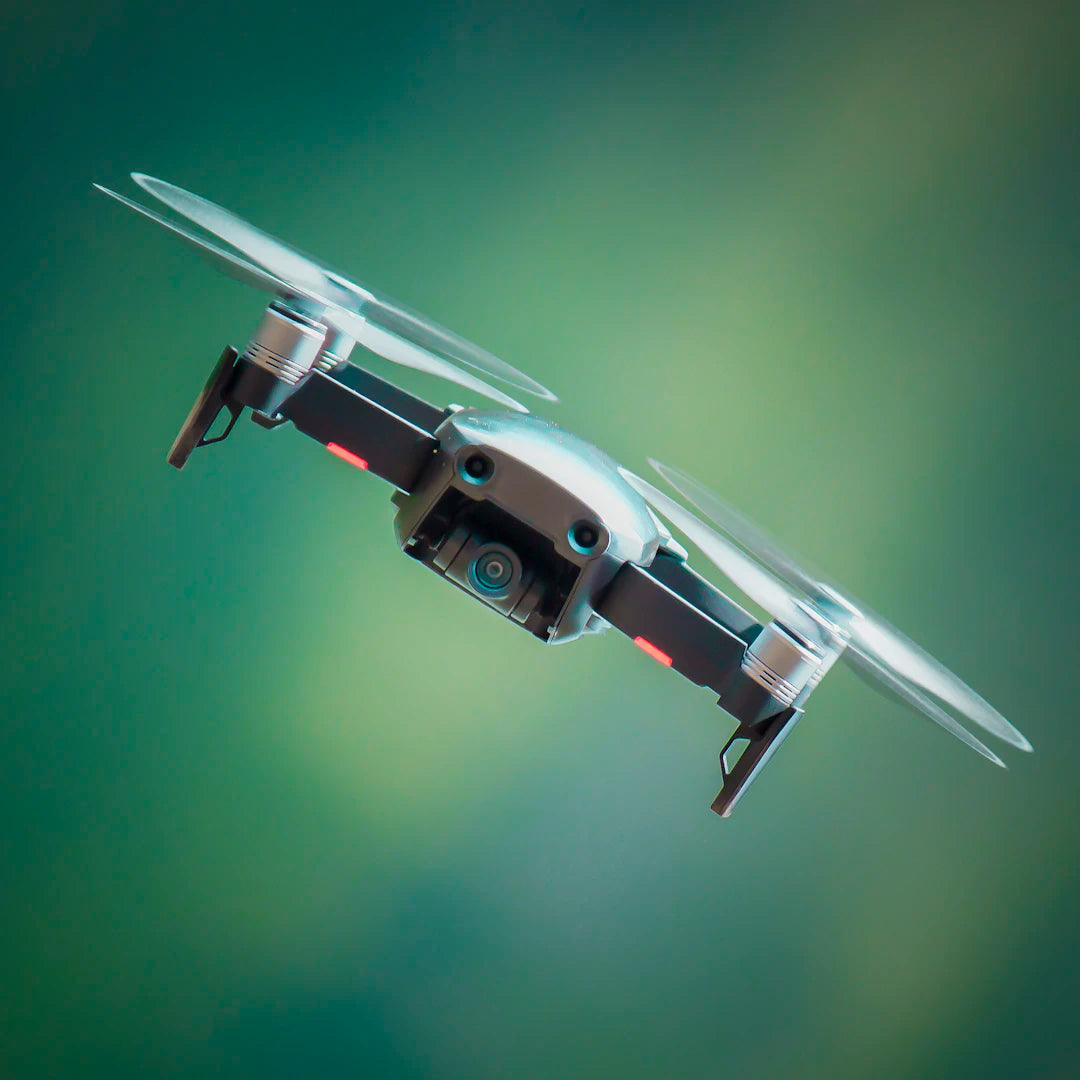
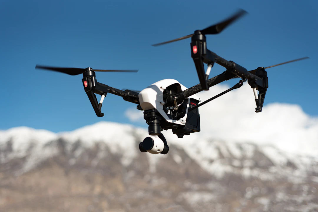
Drones are transforming real estate photography by providing unique aerial perspectives, cost-effective solutions, and advanced data collection capabilities. They enhance property listings with stunning visuals, improve virtual tours, and allow for comprehensive views of large properties. Models like the DJI Mavic 3 Pro offer high-quality cameras and intuitive controls, making drone photography accessible to real estate professionals. The future promises further advancements in technology and regulations, emphasizing the importance of drone photography in modern real estate marketing.
Table of Contents
- Why Use Drones for Real Estate Photography?
- The Technology Behind Aerial Photography
- How Drone LiDAR Works
- The Benefits of Drones Over Traditional Methods
- Highlighting Key Features of Drones in Real Estate
- Camera Quality
- Flight Time
- User-Friendly Controls
- Post-Processing Integrity
- Enhancing Virtual Tours with Drone Technology
- The Future of Drones in Real Estate Photography
- More Real-Time Data Applications
- Enhanced Integration with Marketing Platforms
- Increased Regulation
- Getting Started with Drones in Real Estate Photography
- Step 1: Choose the Right Drone
- Step 2: Learn the Regulations
- Step 3: Master Drone Operations
- Step 4: Experiment with Aerial Photography Techniques
- Step 5: Promote Your New Photography Skills
- A Sky Full of Opportunities
In recent years, the world of real estate photography has seen a dramatic transformation thanks to technological advancements. Among the most influential of these advancements is the use of drones, which are revolutionizing how properties are showcased. Real estate agents and photographers alike are harnessing the power of aerial photography to display listings more effectively, appealing to buyers in a way that ground-level images never could. In this article, we'll discuss how drones are changing the landscape of real estate photography, the technology behind them, and the latest models like the DJI Mavic 3 Pro.
Why Use Drones for Real Estate Photography?
The incorporation of drones into real estate photography offers multiple benefits, making this tool indispensable for agents and photographers. Below are some key advantages:
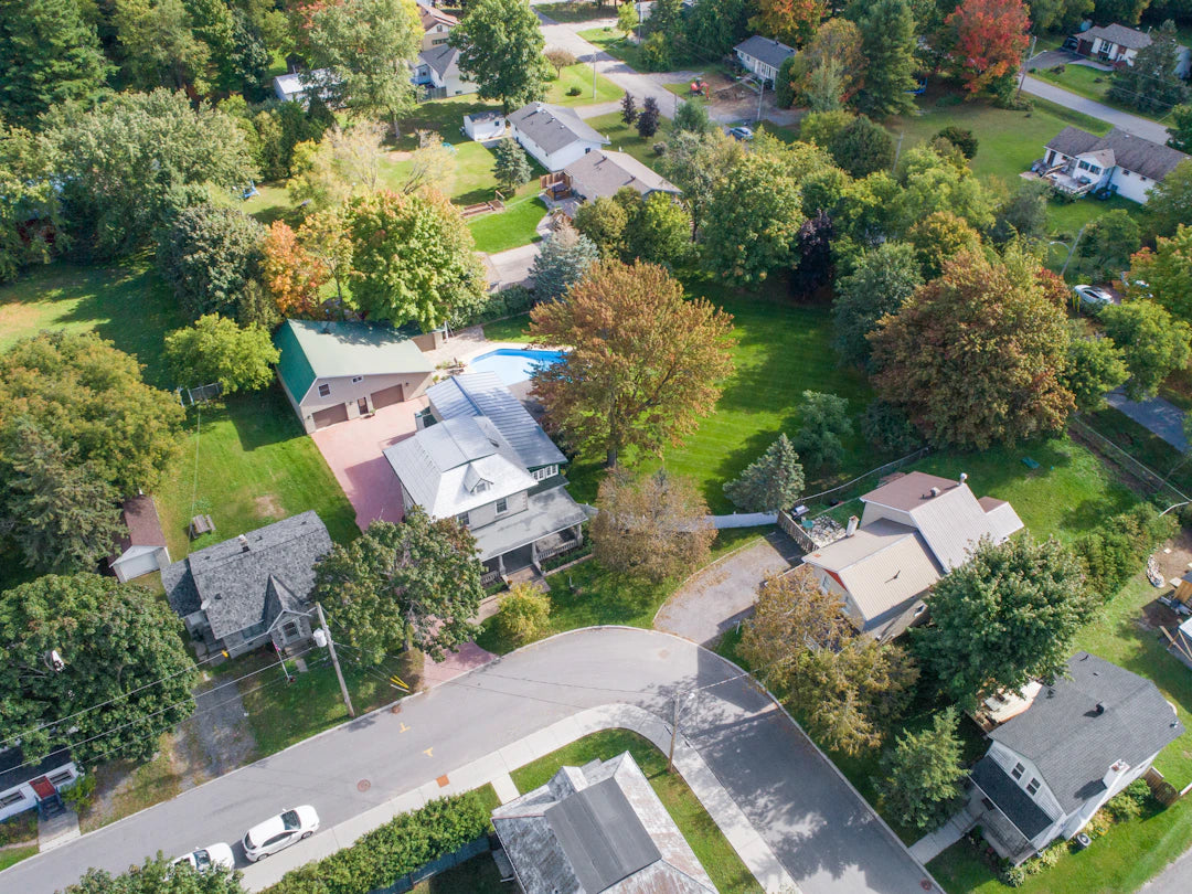
- Aerial Perspectives: Drones provide a unique vantage point, allowing for stunning bird’s-eye views that ground-based photography simply can’t achieve.
- Wide Coverage: Drones can capture large properties and their surroundings in one frame, giving potential buyers a comprehensive view.
- Cost-Effective: Hiring a helicopter for aerial shots is expensive. Drones are a fraction of the cost, making high-quality aerial photography accessible to all.
- Real-Time Data: Drones can be equipped with advanced technology such as how drone LiDAR works, capturing precise data and creating accurate 3D models of properties.
The Technology Behind Aerial Photography
Understanding the technology behind drones enriches our appreciation of what they bring to the table. One of the most impressive types of technology integrated into drones is LiDAR (Light Detection and Ranging), which collects detailed information about the environment. Here's how it works:
How Drone LiDAR Works
LiDAR operates by emitting laser beams from a drone, which bounce off surfaces and return to the sensor. This creates a precise map of the area, capturing features like height variations, vegetation, and structures with incredible accuracy. The data collected can be integrated with other visual elements for a comprehensive look at a property. In real estate, this translates into:
- Creating detailed topographical maps.
- Measuring the distances and dimensions of structures and land.
- Producing accurate 3D models that prospective buyers can explore.
The Benefits of Drones Over Traditional Methods
Before the advent of drones, real estate photography heavily relied on traditional methods such as ground-based photography and aerial shots taken from small aircraft. Here’s how drones outperform these methods:
| Criteria | Traditional Methods | Drones |
|---|---|---|
| Cost | Typically high due to helicopter rentals | Affordable; less expensive to operate |
| Angle of View | Limited perspectives from ground level | Varied and dynamic angles from the sky |
| Data Collection | Static images only | Real-time data capture including LiDAR |
| Processing Time | Longer due to equipment setup | Quicker setup and immediate results |
Highlighting Key Features of Drones in Real Estate
The emergence of models like the DJI Mavic 3 Pro has brought forth significant features designed specifically for real estate professionals. Below, we highlight some features that real estate photographers should look for when choosing a drone:
Camera Quality
High-resolution cameras are a must for capturing details. The DJI Mavic 3 Pro, for instance, boasts a larger sensor that can capture stunning images even in low-light conditions. This capability enables photographers to deliver high-quality images for listings at any time of day.
Flight Time
Longer flight times translate into more opportunities for capturing the perfect shot. The DJI Mavic 3 Pro has an impressive flight time, allowing photographers to maximize their shooting sessions without interruptions.
User-Friendly Controls
Drones today offer intuitive controls, making it easier for users to capture the shots they need quickly. The Mavic series includes intelligent shooting modes, automating complex maneuvers and reducing the skill barrier for new drone pilots.
Post-Processing Integrity
High-quality images not only need to be captured well, but they must also hold up during post-processing. Drones like the DJI Mavic 3 Pro produce images that maintain their integrity and detail even after editing, ensuring that the final product remains professional and appealing.
Enhancing Virtual Tours with Drone Technology
In today’s market, virtual tours are increasingly popular among buyers who wish to view properties from the comfort of their homes. Integrating drone footage enhances the virtual experience by providing aerial insights. Here’s how drones elevate virtual tours:
- Comprehensive Views: Drones capture views that give potential buyers a true sense of the layout and position of properties within their landscape.
- Engaging Content: High-quality visuals draw viewers in, making the property feel more welcoming and real.
- Time Efficiency: Buyers can view multiple properties virtually, saving time for both agents and prospective clients.
The Future of Drones in Real Estate Photography
The trajectory of drone technology in real estate photography seems promising. As the technology continues to evolve, we can expect to see further enhancements in features, ease of use, and cost-effectiveness. The proliferation of drones in real estate will likely lead to:
More Real-Time Data Applications
With advancements in drone technology and data processing, real estate professionals will increasingly leverage real-time data analytics, leading to more informed decision-making for agents and buyers.
Enhanced Integration with Marketing Platforms
As drone footage becomes a staple in real estate marketing, we expect to see more platforms that support seamless integration of aerial videos and photos into listings, website layouts, and social media channels.
Increased Regulation
As the usage of drones becomes more prevalent, regulations and guidelines surrounding drone operations will likely become more stringent, necessitating certifications for operators and emphasizing best practices.
Getting Started with Drones in Real Estate Photography
If you're a real estate professional looking to improve your photography game or a photographer seeking to expand your offerings, the following steps can help you get started with drone photography:
Step 1: Choose the Right Drone
Invest in a high-quality drone equipped with excellent camera capabilities, like the DJI Mavic 3 Pro. Consider factors like camera quality, flight time, and ease of use.
Step 2: Learn the Regulations
Familiarize yourself with local regulations governing drone use, including necessary licenses or permits. This ensures you operate within legal boundaries and avoid fines.
Step 3: Master Drone Operations
Take time to learn how to operate your drone effectively. Consider enrolling in courses or watching online tutorials to hone your skills.
Step 4: Experiment with Aerial Photography Techniques
Practice flying your drone in different environments and conditions. Try out various aerial photography techniques to discover what works best for your style and listings.
Step 5: Promote Your New Photography Skills
Use social media platforms, your business website, and local real estate networks to showcase your aerial photography. Engage with your audience by sharing stunning images and videos.
A Sky Full of Opportunities
With the advancing capabilities of drones and features like those found in the DJI Mavic 3 Pro, the possibilities for real estate photography are dramatically evolving. Agents who adopt this technology will not only stand out in a competitive market but also provide a unique experience for their clients. So, take to the skies and elevate your listings with drone photography, ensuring your properties are captured in their best light for potential buyers!
Key Takeaways
- Drones offer aerial perspectives that enhance property visibility and attract potential buyers with unique bird’s-eye views.
- Cost-effective solution compared to traditional aerial photography methods, making high-quality images accessible to more agents and photographers.
- Advanced technology like LiDAR allows for real-time data collection, creating accurate 3D models and detailed topographical maps.
- Models like the DJI Mavic 3 Pro feature high-resolution cameras, long flight times, and user-friendly controls, making them ideal for real estate photography.
- Drones enhance virtual tours by providing comprehensive views and engaging content, saving time for both agents and buyers.
- Future developments in drone technology will likely include more real-time data applications and enhanced integration with marketing platforms.
- Learning to operate drones effectively and familiarizing yourself with regulations is essential for real estate professionals looking to utilize this technology.
Pros and Cons
| Advantages of Drones in Real Estate Photography | Drawbacks of Drones in Real Estate Photography |
|---|---|
| Aerial perspectives offer unique views of properties. | Weather conditions can limit drone usage. |
| Cost-effective compared to traditional aerial methods. | Initial investment in quality drones can be high. |
| Ability to capture real-time data with advanced technology. | Complex regulations and licensing requirements exist. |
| Enhances virtual tours with comprehensive views. | Requires skill and training to operate effectively. |
| Dynamic angles improve property marketing. | Potential privacy concerns for neighboring properties. |
Linked Product

DJI Mavic 3 Pro Three Camera Flagship Aerial Camera DJI Mavic 3 Pro Cine HD Professional Master Edition Aerial Camera
The DJI Mavic 3 Pro is equipped with three cameras, offering versatile options for capturing high-quality aerial photography with a pixel count of 18 million or above. With a battery life of up to 43 minutes and a maximum flight altitude of over 120 meters, it provides extended flight time and impressive coverage for real estate photography. Additionally, its intelligent obstacle avoidance function enhances safety during operation, making it a reliable tool for professionals in the field.
View ProductWho It's For (And Not For)
Who It's For
- Real Estate Agents: Those looking to enhance their property listings with stunning aerial views and comprehensive coverage.
- Professional Photographers: Photographers aiming to expand their services and incorporate cutting-edge technology into their portfolio.
- Tech Enthusiasts: Individuals interested in utilizing advanced drone technology and LiDAR for detailed property analysis.
- Agents Focused on Marketing: Professionals wanting to create engaging virtual tours and attract more potential buyers through high-quality visuals.
Who It's Not For
- Budget-Conscious Agents: Those who cannot invest in the initial costs of drones and the necessary equipment may find it challenging to adopt this technology.
- Individuals Uncomfortable with Technology: Those who are not tech-savvy or unwilling to learn how to operate drones may struggle with this approach.
- Agents in Highly Regulated Areas: Professionals in regions with strict drone regulations may face hurdles in obtaining the necessary permits and licenses.
- Traditionalists: Real estate agents who prefer conventional photography methods and are not interested in modernizing their approach may not benefit from drone technology.
Frequently Asked Questions
1. What are the benefits of using drones in real estate photography?
2. How does drone LiDAR technology work?
3. What advantages do drones have over traditional real estate photography methods?
4. What features should photographers look for in a drone for real estate?
5. What steps should a real estate professional take to get started with drone photography?
Glossary
| Term | Meaning |
|---|---|
| Drones | Unmanned aerial vehicles used for capturing images and videos from the sky. |
| Aerial Photography | Photography taken from an elevated position, typically using drones. |
| LiDAR | Light Detection and Ranging; a technology for mapping and measuring distances using laser light. |
| DJI Mavic 3 Pro | A popular drone model known for its high-quality camera and long flight time. |
| Virtual Tours | Online experiences allowing potential buyers to view properties remotely. |
| Post-Processing | The editing of images after they have been captured to enhance quality. |
| Real-Time Data | Information collected and analyzed instantly, often using drone technology. |
| Angle of View | The perspective from which a photograph is taken, crucial for showcasing properties. |
| Comprehensive View | A complete perspective of a property and its surroundings in a single image. |
| Regulations | Legal guidelines governing the use of drones in various locations. |