
How Drones Are Changing Environmental Conservation
Overview
Drones are revolutionizing environmental conservation through wildlife monitoring, reforestation, and tracking environmental changes. They aid in anti-poaching efforts, enhance reforestation projects with seed bombing, and collect crucial data for climate monitoring. The technology fosters community engagement and is expected to become more accessible and integrated with AI for better decision-making in conservation strategies.
Table of Contents
- Wildlife Monitoring and Protection
- Case Studies of Successful Wildlife Drones
- Reforestation and Habitat Restoration
- Innovative Approaches to Drones in Reforestation
- Monitoring Environmental Changes
- Wide-Scale Data Collection
- Best Underwater Drones for Conservation
- Community Engagement and Education
- The Future of Drones in Conservation
- Join the Green Revolution
The advancement of technology has led to numerous innovative uses of drones, especially in the field of environmental conservation. As environmental challenges continue to grow, drones offer uncharted solutions. In this blog, we explore various innovative methods where drones are making a significant impact in conserving our planet. From monitoring wildlife to aiding in reforestation projects, the versatility of drones like the Autel EVO II 640T proves to be invaluable. Let’s dive deeper into how these aerial devices are revolutionizing the conservation landscape.
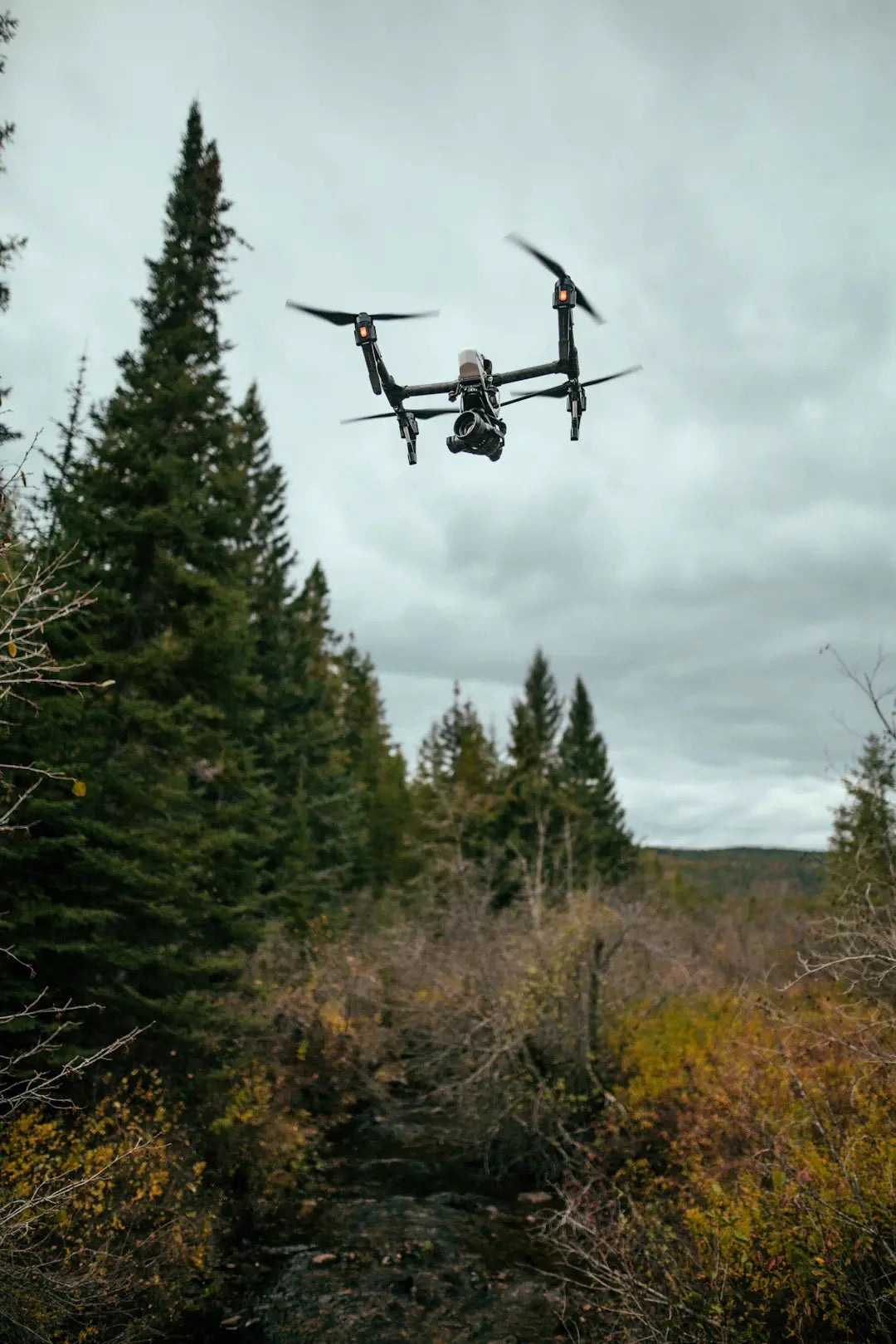
Wildlife Monitoring and Protection
Drones have emerged as a critical tool for wildlife conservationists. With their ability to cover vast areas quickly, they are particularly useful in monitoring wildlife populations and habitats. Here's how they contribute:
- Population Surveys: Drones can photograph and offer real-time data on wildlife populations without disturbing their natural habitats.
- Anti-Poaching Efforts: Drones equipped with thermal imaging cameras can spot poachers and illegal activities in dense forests, offering a safer way to patrol these areas.
- Tracking Migration Patterns: By collecting data from aerial views, conservationists can study animal migration and understand their behaviors better.
Case Studies of Successful Wildlife Drones
Many wildlife organizations have started using drones in their operations with promising results. Here are a few notable examples:
| Organization | Location | Drone Used | Impact |
|---|---|---|---|
| World Wildlife Fund | Africa | DJI Phantom 4 | Reduced poaching incidents by 80% in targeted areas. |
| Conservation International | Amazon Rainforest | Parrot Anafi | Improved forest health monitoring with increased data accuracy. |
| Wildlife Conservation Society | Southeast Asia | Autel EVO II 640T | Improved monitoring of endangered species and habitats. |
Reforestation and Habitat Restoration
Another area where drones are making strides is in reforestation. Through innovative techniques, drones are being used to plant trees at an unprecedented scale. This section outlines the key features:
- Seed Bombing: Drones can drop seed pods in remote or hard-to-reach areas to enhance reforestation efforts.
- Location Mapping: With advanced mapping technologies, drones can identify deforested areas that need urgent attention.
- Soil Quality Assessment: Drones can assess soil quality and analyze data to determine the best locations for planting.
Innovative Approaches to Drones in Reforestation
Organizations have implemented several drone-based strategies for effective reforestation:
| Project Name | Location | Drones Used | Results |
|---|---|---|---|
| BioCarbon Engineering | UK | Fixed-wing Drones | Successfully planted over a million trees in just a few months. |
| DroneSeed | USA | Custom Drone Fleet | Reforested more than 12 square miles after wildfires. |
| AirSeed Technologies | Australia | Drones with 3D-printed seed pods | Attempting to plant 100 million trees by 2026. |
Monitoring Environmental Changes
Drones prove crucial in tracking environmental changes such as deforestation, glacial melting, and changes in land use. Their ability to collect detailed aerial data allows scientists to make informed decisions regarding environmental policies.
- Climate Monitoring: Drones can monitor atmospheric conditions and collect data related to climate change.
- Coastal Erosion Analysis: They can map coastlines over time, providing valuable data on erosion rates.
- Land Use Changes: Drones analyze land use patterns, providing insights into agricultural expansion and urban development.
Wide-Scale Data Collection
Drones collect high-resolution imagery that captures changes over time. Such data is essential for:
- Aiding in research for affected ecosystems.
- Guiding conservation planning.
- Supporting community engagement and education on environmental issues.
Best Underwater Drones for Conservation
While aerial drones dominate conversations around environmental conservation, underwater drones offer incredible capabilities for exploring and protecting aquatic ecosystems. Here's a look at some of the best underwater drones for fishing and conservation:
| Drone Model | Key Features | Price Range | Ideal Usage |
|---|---|---|---|
| RoboSea | Depth up to 300 meters, 4K video | $1,000 - $2,000 | Underwater exploration and habitat monitoring. |
| PowerVision PowerRay | 4K HDR video, fish finding capabilities | $1,500 - $3,000 | Fishing and environmental monitoring. |
| Aurora ATX | AI navigation, depth monitoring | $2,500 - $4,500 | Research and rescue operations. |
Community Engagement and Education
Beyond data collection and monitoring, drones play a significant role in engaging local communities in conservation efforts. Educational programs that incorporate drone technology can inspire future conservationists and raise awareness about environmental issues.
- Workshops and Training: Host workshops that provide hands-on experience with drone technology to engage students and local communities.
- Awareness Campaigns: Utilize drone footage to create engaging content for social media and community outreach.
- Participatory Projects: Involve community volunteers in drone-assisted monitoring efforts, fostering a sense of ownership over local conservation projects.
The Future of Drones in Conservation
The future of drones in environmental conservation looks promising. With continuous advancements in technology, drones will enhance data collection, improve habitat monitoring, and foster community involvement in sustainable practices. Here are some anticipated trends:
- Drones will become more affordable and accessible for small organizations and local communities.
- Innovative user-friendly interfaces will simplify the operation of drones for non-experts.
- Integration with artificial intelligence will elevate data analysis capabilities, leading to quicker decision-making in conservation strategies.
Join the Green Revolution
As we have explored throughout this article, drones represent a significant shift in how we approach environmental conservation. From wildlife protection to reforestation efforts, their uses are varied and impactful. For those interested in engaging with this technology or wanting to learn more about the potential of drones like the Autel EVO II 640T and the Best Underwater Drones for Fishing, it's time to join the green revolution! Together, we can harness the power of drones to safeguard our planet for generations to come.
Key Takeaways
- Drones enhance wildlife conservation: They enable quick and efficient monitoring of wildlife populations and habitats.
- Effective anti-poaching tool: Drones with thermal imaging help detect poachers and illegal activities in remote areas.
- Innovative reforestation techniques: Drones can plant trees and assess soil quality, significantly boosting reforestation efforts.
- Wide-scale environmental monitoring: Drones track changes like deforestation and climate shifts, aiding in informed policy-making.
- Community engagement: Drones facilitate educational programs that inspire local involvement in conservation projects.
- Future advancements: Drones are expected to become more affordable and user-friendly, enhancing their accessibility for conservation efforts.
- Underwater drones for aquatic ecosystems: These devices are crucial for monitoring and protecting underwater habitats.
Pros and Cons
| Advantages of Drones in Conservation | Drawbacks of Drones in Conservation |
|---|---|
| Ability to cover vast areas quickly for wildlife monitoring. | High initial investment costs for advanced drone technology. |
| Enhanced data collection for informed decision-making. | Potential privacy concerns in monitored areas. |
| Support for reforestation efforts through seed bombing. | Dependence on technology may reduce traditional conservation skills. |
| Engagement of communities in conservation through educational programs. | Technical challenges may arise for non-expert users. |
| Real-time monitoring aids in anti-poaching efforts. | Environmental impact of drone operations if not managed properly. |
Linked Product

Autel Robotics EVO II 640T Thermal and Visual Gimbal Camera
The Autel Robotics EVO II 640T features both thermal and visual gimbal cameras, making it suitable for a variety of environmental conservation applications. With its advanced thermal imaging capabilities, including ten color palettes and isotherms, it can effectively assist in wildlife monitoring and habitat assessment. Additionally, the high-resolution visual camera supports various photography modes and video formats, enabling detailed documentation and analysis of environmental conditions.
View ProductWho It's For (And Not For)
Who It's For
- Environmental Conservationists: If you are actively involved in conservation efforts and looking for innovative tools to enhance your work.
- Wildlife Monitors: Ideal for those needing to track and protect wildlife populations without disturbing their habitats.
- Reforestation Initiatives: Perfect for organizations focused on large-scale tree planting and habitat restoration.
- Community Educators: Great for educators aiming to engage communities in conservation through technology.
- Researchers: Suitable for those who require detailed aerial data to inform environmental policies and studies.
Who It's Not For
- Individuals with No Interest in Technology: If you are not interested in utilizing technology for environmental efforts, drones may not be relevant for you.
- Organizations with Limited Budgets: Those unable to invest in drone technology or training may find it challenging to implement.
- Non-Environmental Focus: If your work or interests lie outside of environmental conservation, drones may not align with your goals.
- People Unfamiliar with Aerial Data: If you lack experience in data collection and analysis, the benefits of drones may not be fully realized.
- Non-Collaborative Entities: Those who prefer to work independently without community involvement may not benefit from drone-assisted projects.
Frequently Asked Questions
1. How are drones used in wildlife monitoring?
2. What innovative techniques are drones used for in reforestation?
3. What data can drones collect for monitoring environmental changes?
4. What are some examples of community engagement through drones?
5. What is the future outlook for drones in environmental conservation?
Glossary
| Term | Meaning |
|---|---|
| Drones | Aerial devices used for various applications, including conservation. |
| Wildlife Monitoring | Using drones to track and observe animal populations and habitats. |
| Seed Bombing | Dropping seed pods from drones to promote reforestation. |
| Thermal Imaging | Technology used by drones to detect heat signatures, useful in anti-poaching. |
| Climate Monitoring | Tracking atmospheric conditions and climate change data with drones. |
| Community Engagement | Involving local people in conservation efforts through educational programs. |
| Coastal Erosion | Using drones to analyze and map changes in coastlines over time. |
| Data Collection | Gathering high-resolution imagery to inform environmental decisions. |
| Participatory Projects | Community-driven initiatives that utilize drones for monitoring efforts. |
| AI Integration | Combining artificial intelligence with drones for enhanced data analysis. |